Overdose Mortality Rates in NC, 2025
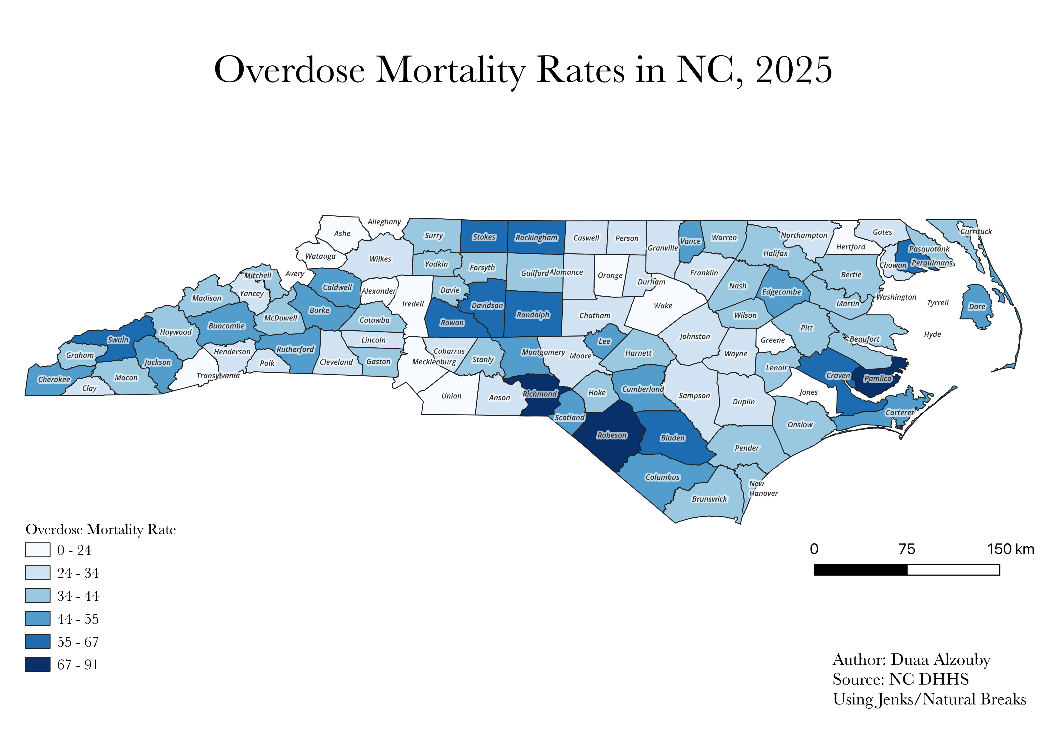
County-level choropleth map of overdose mortality rates across North Carolina using NC DHHS data and Jenks natural breaks classification.
QGIS
Choropleth Mapping
Jenks Classification
NC DHHS Data
A collection of QGIS maps spanning public health, recreational infrastructure, and emergency service coverage in North Carolina.
County-level choropleth map of overdose mortality rates across North Carolina using NC DHHS data and Jenks natural breaks classification.
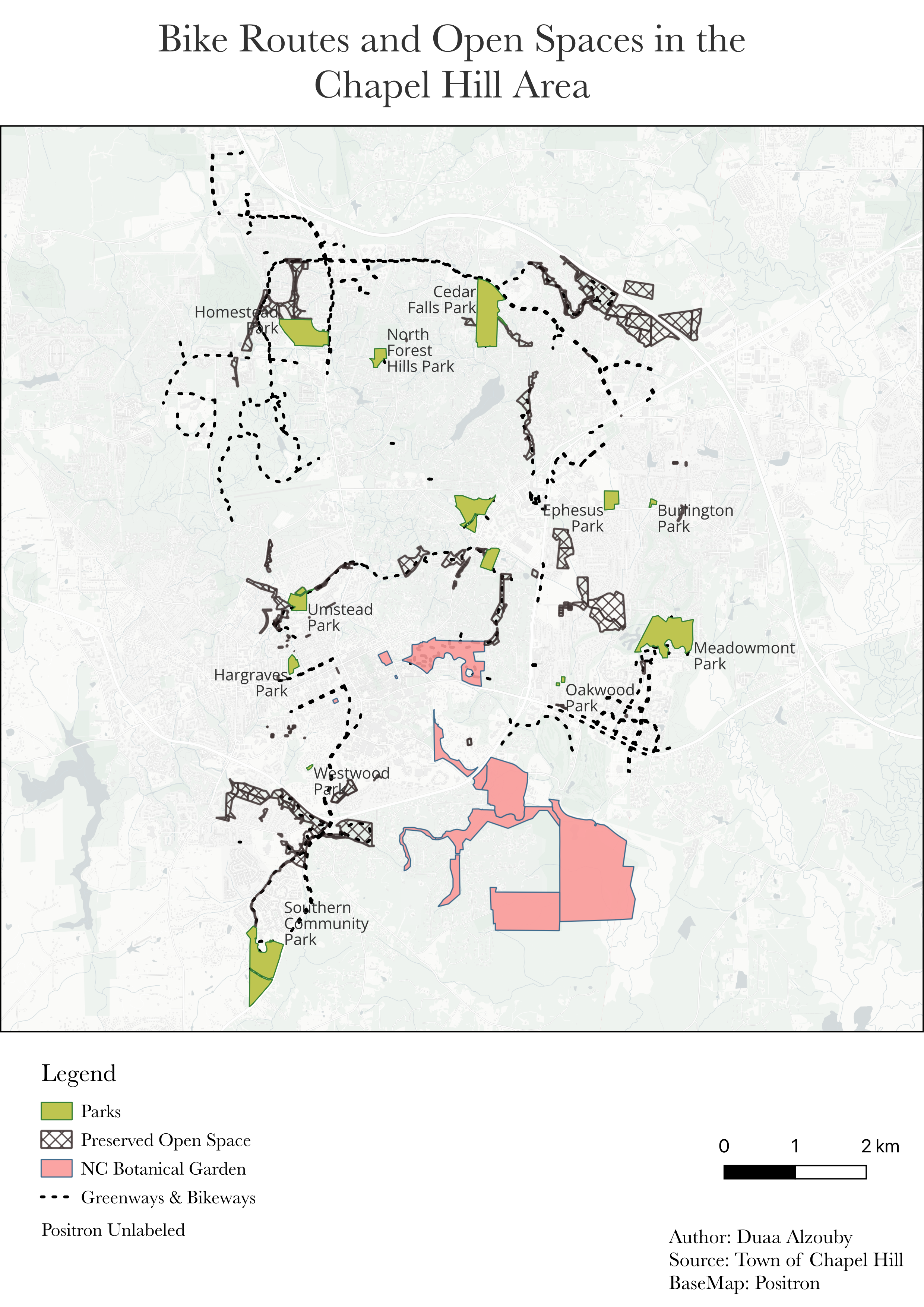
Thematic map of parks, preserved open space, the NC Botanical Garden, and greenway and bikeway networks across Chapel Hill.
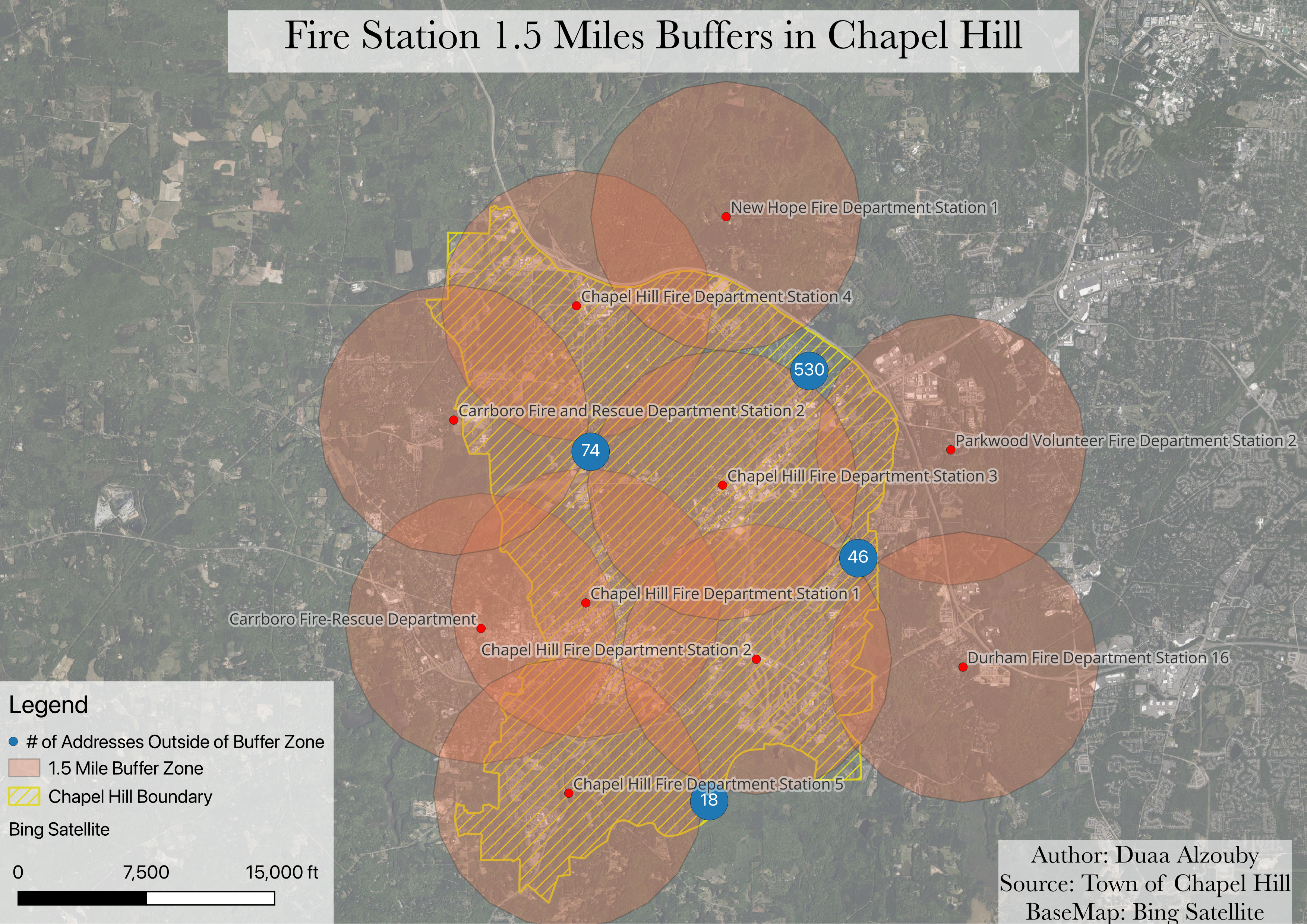
Buffer analysis identifying addresses within the Chapel Hill boundary that fall outside the 1.5-mile service radius of nearby fire stations.