Back to Projects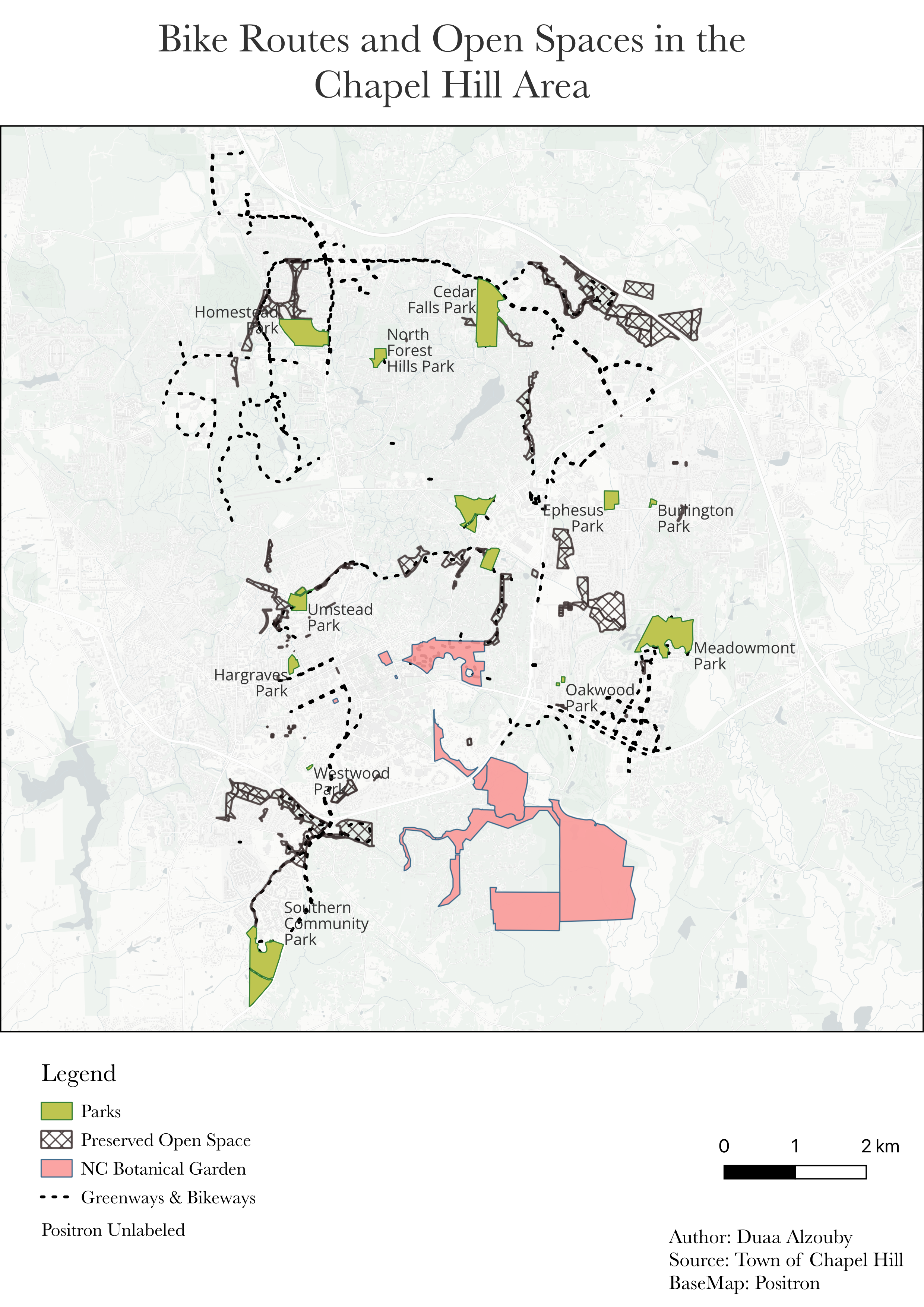
GIS Projects
Spatial analysis, cartography, remote sensing, and geospatial visualization work.
Ramadan Lights
Remote sensing analysis of Ramadan nighttime light patterns with interactive Earth Engine app and presentation.
Google Earth Engine
Remote Sensing
Satellite Imagery
GIS
GIS Map Gallery
A collection of QGIS maps including NC overdose mortality, Chapel Hill bike routes, and fire station buffer analysis.
QGIS
Choropleth Mapping
Buffer Analysis
Urban GIS
Chapel Hill GIS Presentation
Final presentation covering GIS mapping and spatial analysis work in the Chapel Hill area.
QGIS
Spatial Analysis
Urban Planning
Presentation
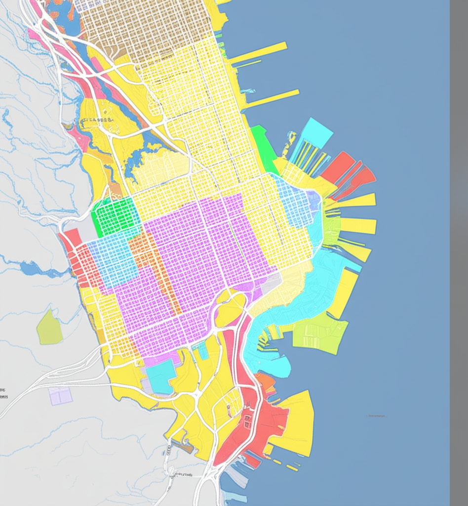
Art Center Site Suitability
Used spatial analysis to find the optimal site in San Francisco for a community art center.
QGIS
GeoJSON
Spatial Joins
Zoning Filters
Exploratory Spatial Data Analysis
Hot spot analysis and Moran's I to identify vulnerability clusters in census tract data.
Spatial Analysis
Hot Spot Analysis
Moran's I
Census Data